
In a recent trip to Arunachal Pradesh, the Indian land of the rising sun (a place that famously goes dark at 430pm), I was able to unlock a rather untouched part of India (for myself) and add it to a growing collection of epic road trips across the country. The great Northeast of our country, an expanding tourist hotspot, provided an enthralling journey for my family over a long, 10-day trip in its mountains!
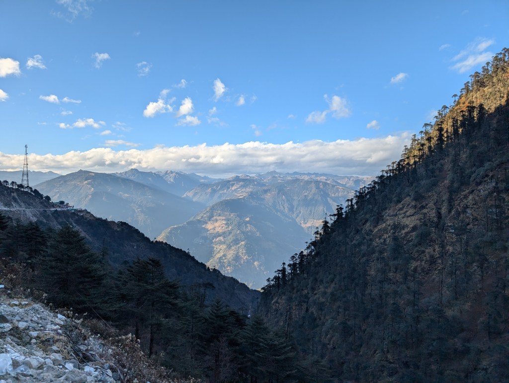
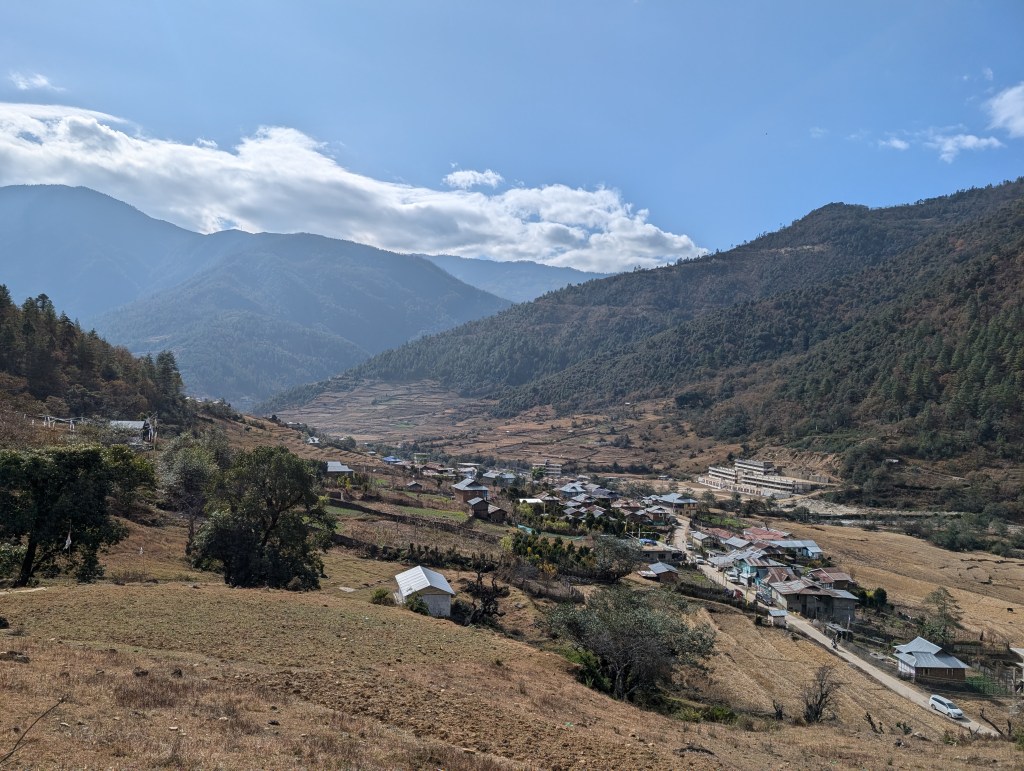
Right of the bat: I’ve had my fair share of Himalayan excursions – Ladakh, Uttarakhand, Himachal Pradesh – but never this far east. I’ve always believed that each gateway to these mountains boasts an excitingly different biome and scenery. Leh’s mountains are dry and sandy; ex-Dehradun, it’s a bit more vegetative and green. Believe me when I say, despite these wonders, I truly fell in love with Arunachal’s rolling mountains; so green in the winter, I can’t imagine what they’re like in the rainy season!
While it would be too tiresome (and slightly impractical) to go back to the olden days of my travel blogs which held meticulous day-to-day records, I thought it would be best to write this one out in sections; while it is my hope that you stick around to the end (for a fun surprise too), having sections means you can skip ones you aren’t interested in. I will try my best to make sure each section is independent, so you don’t lose the flow if you choose to skip. It’s about time I realized that the only people reading full-length travelogues are my future self (when I’m in a nostalgic mood) and my grandfather (truly my primary audience).
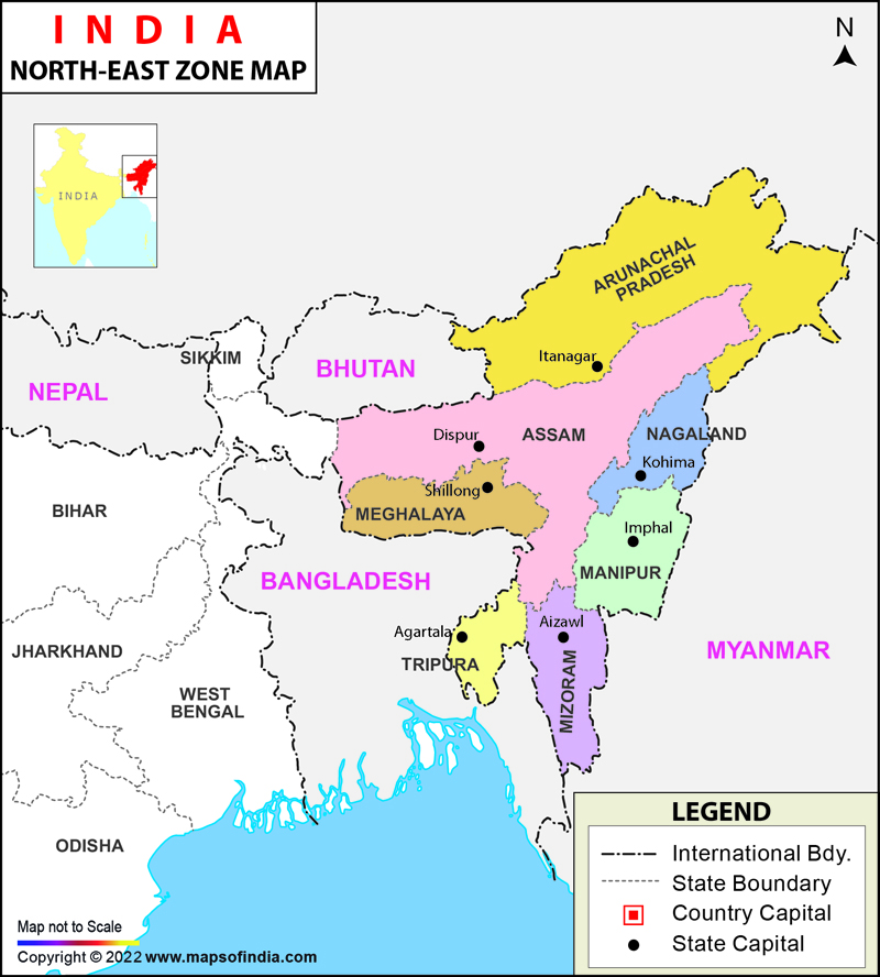
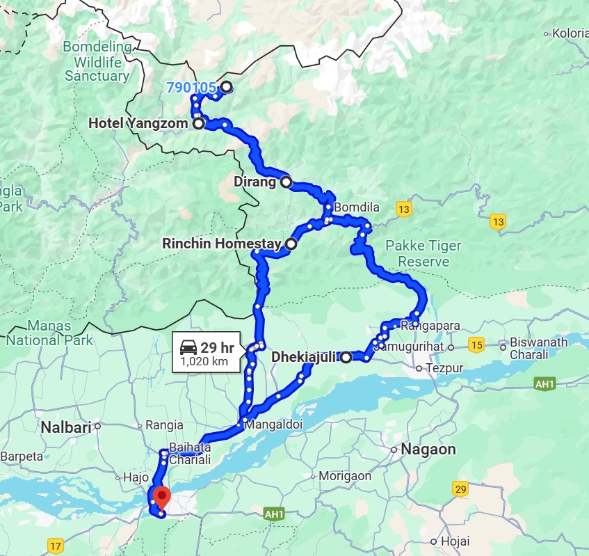
Just so we have a timeline in place, we began our trip from Guwahati Airport (GAU, Assam) on the 27th of December, 2024, and stayed nights in Arunachal Pradesh’s Shergaon, Tawang, and Dirang, and a night each in Assam’s Dekhiajuli and Guwahati before returning on the 5th of January, 2025. Here’s a map of the region that I pulled from the Internet alongside a route map I made.
The blog is split (haphazardly) into the following sections: Places, Drives, Borders, Religion and Culture, and Future Tourism. Choose your own adventure!
Places
The wonderful part of doing sections is now I can give you highlights ranked by importance, rather than chronologically!
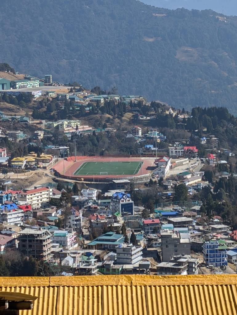
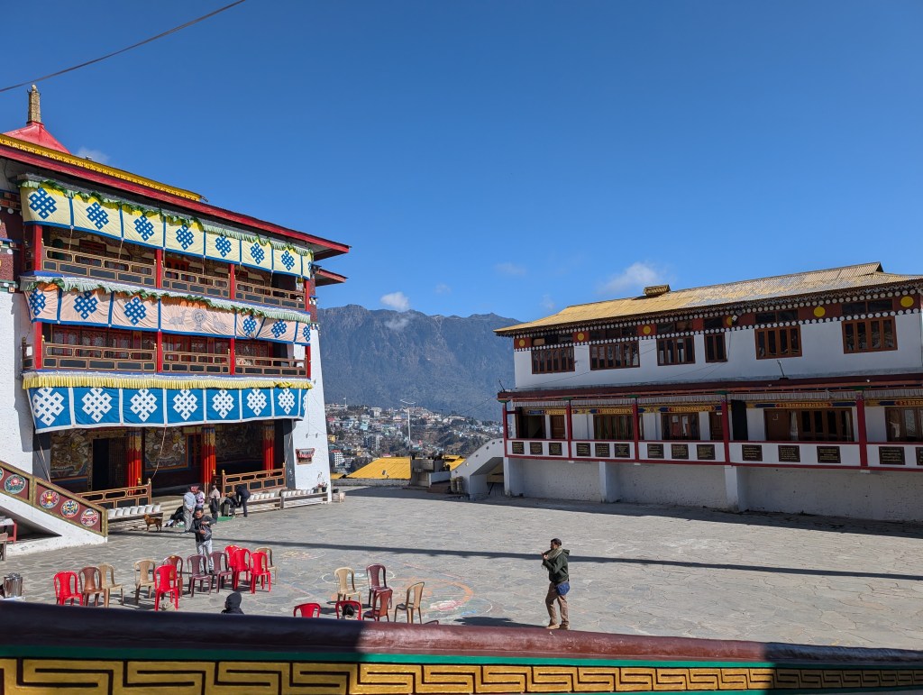
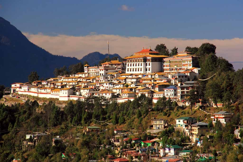
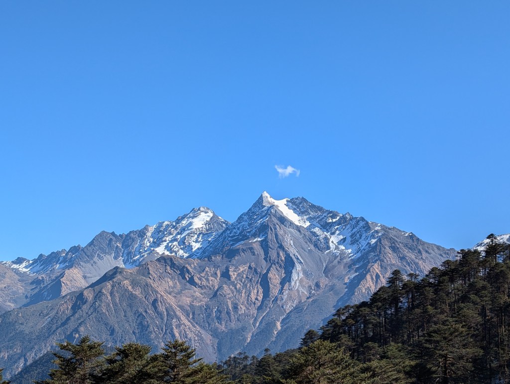
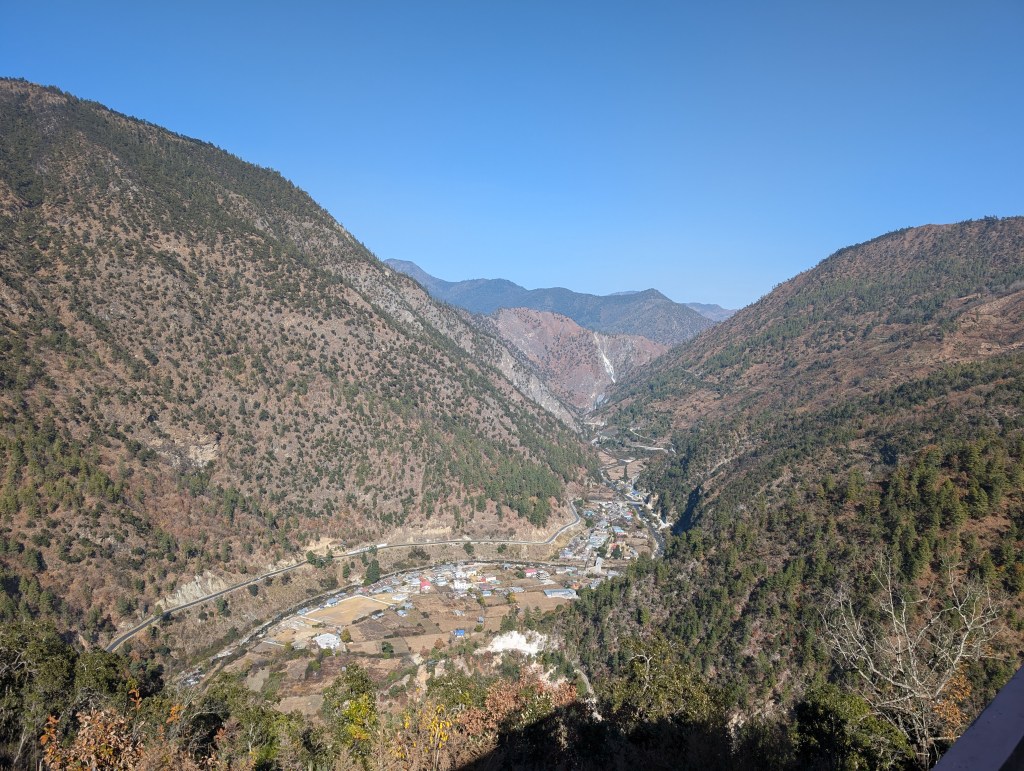
Tawang, the last major town before the border with China, is nestled high up in the mountains. The hillside creates levels in this town; as you drive to it in the dark, you’ll see lights dotted across (really one of my favourite sights). You can look over the entire valley from a place high-enough and see in great detail the constant activity of this proper ‘pahadi’ (lt. hilly) town. With its sharp hills that surely test every driver’s clutches and promises strong quads for its residents, constant army truck movement, narrow crowded main streets that needs a highly evolved sense of Tetris to navigate, and growing construction of houses and buildings around every corner creating a haze of dust, you wouldn’t guess this was a quiet, monastery sleepy-town not too long ago!

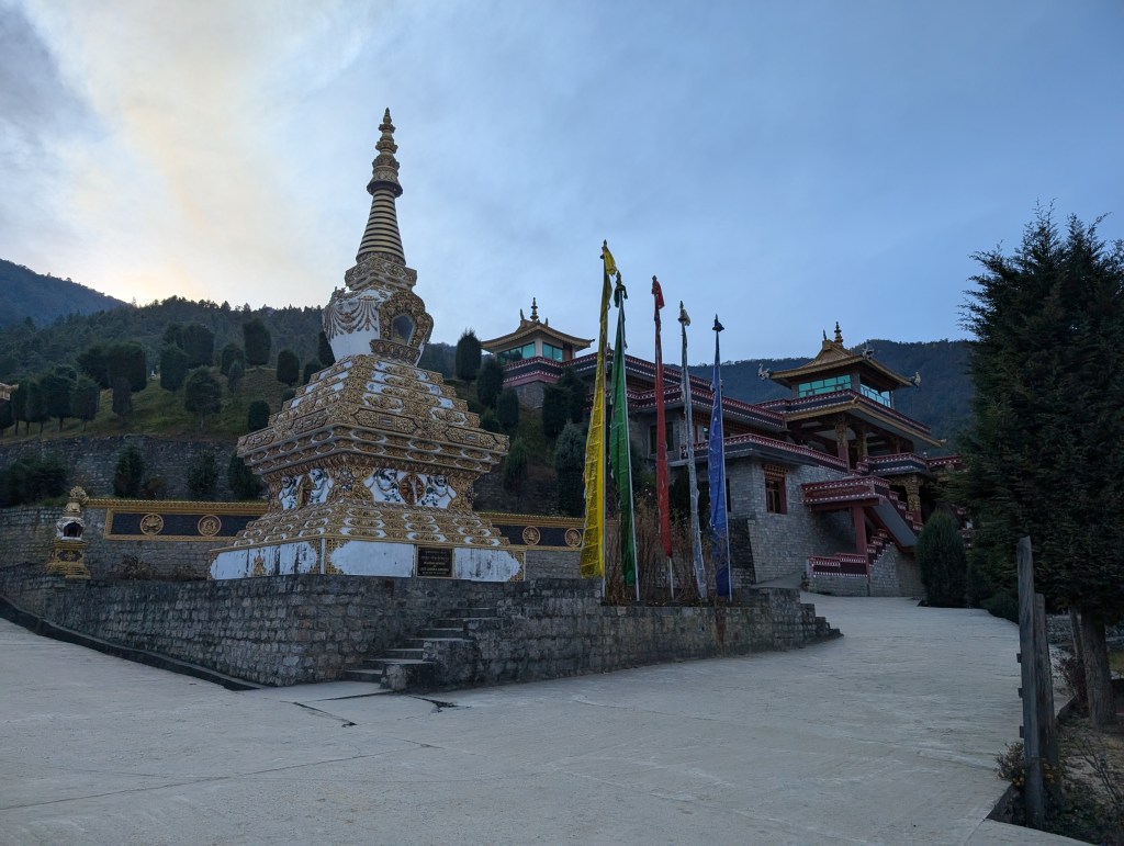
Tawang is known for its monastery, the largest in India (and third largest in the world), which is situated atop a hillock, with its white, glistening compound reminding me of ancient Roman structures every time I looked across the valley. The Tawang market is a complex mix of the past and the future; like any small-town commotion-filled marketplace, there were very visible generational shops, with uniform green shutters and a common lettering to their names. The relaxed pahadi vibe was on display, with some shopkeepers leaving their wares unattended as they enjoyed long lunches and possible sensible siestas for hours before ultimately deciding to just shut shop for the day. Everyone moved slowly, which really opposed the ever-moving ‘bhaag daud’ (rushed) Bombay city attitude I’ve come to expect. Back home, people have places to be and will hastily help you along your way; here, expect a chat, a laissez-faire stroll to the back and a Zootopian sloth’s speed in handing you your purchase. In between, we also found an outcropping of new cafes, with their clever names, typography and fancy facades built by the next generation of Tawang. Amongst this wave of modernization we also spotted a brand-new football stadium right in the middle of the city boasting a manicured green and towering flood lights, one of my favourite sites to peer over from across the valley.
Drives
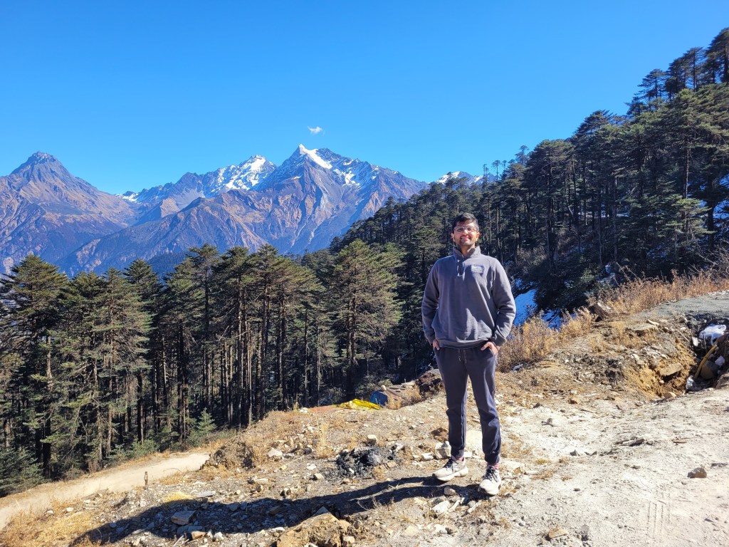
I think I’ve spent more time dreaming about writing this section than actually putting pen to paper. The drives and its accompanying views really were the highlight of this trip, and made the long, almost daily 8hr car commitments worth it.
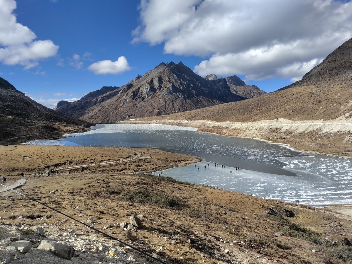
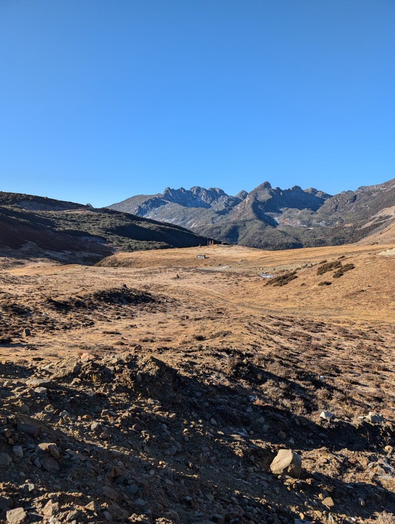
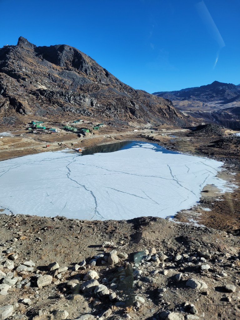
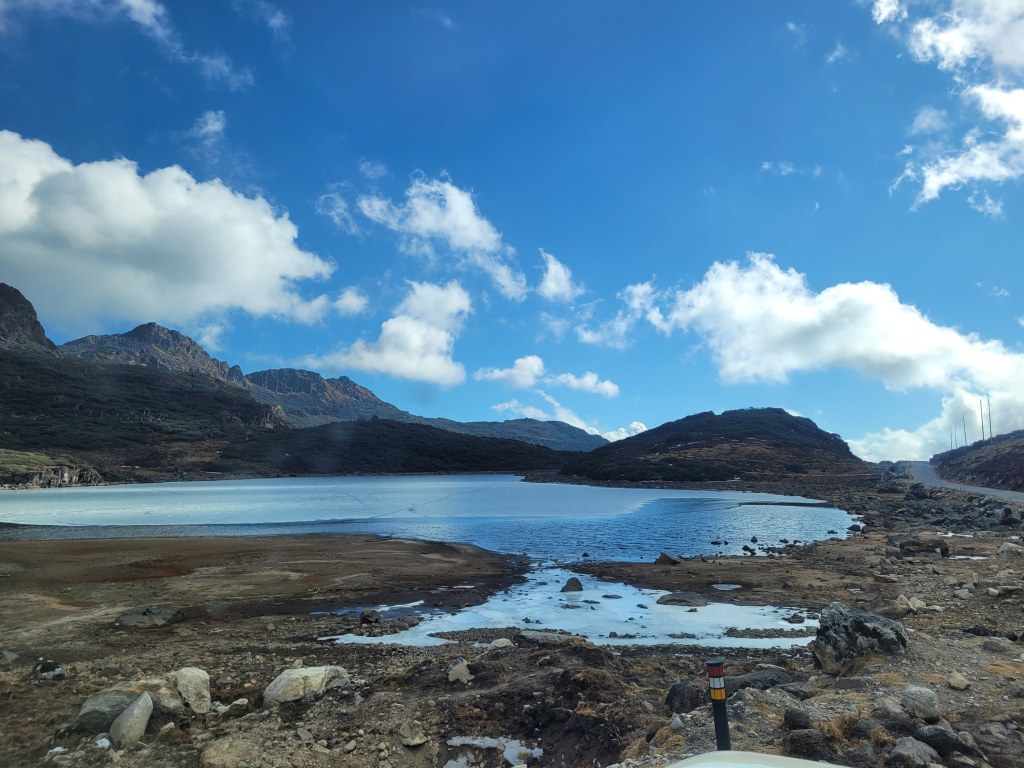
While the valleys we crossed were jaw-dropping and forced me to take as many pictures as parents do on their iPads during school performances, the high-altitude frozen lakes were the biggest surprise. The Sela lake at 13000+ ft with its deep blue water and glistening snow-white ice sequestered in-between rising hills simply took my breadth away. While it was probably not environmentally nor tourist friendly for me to join the hordes of people scampering on the semi-frozen lake, it really was a once-in-a-lifetime opportunity. I am also happy to report that the intrusive thoughts of sliding like a penguin on the ice did not win that day!
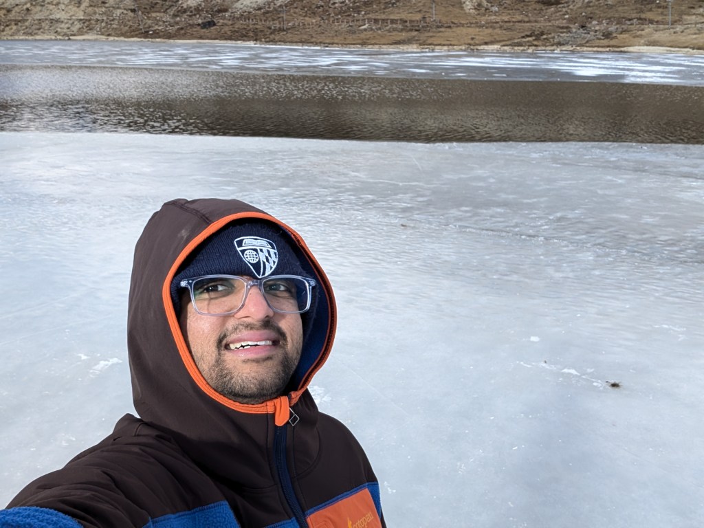
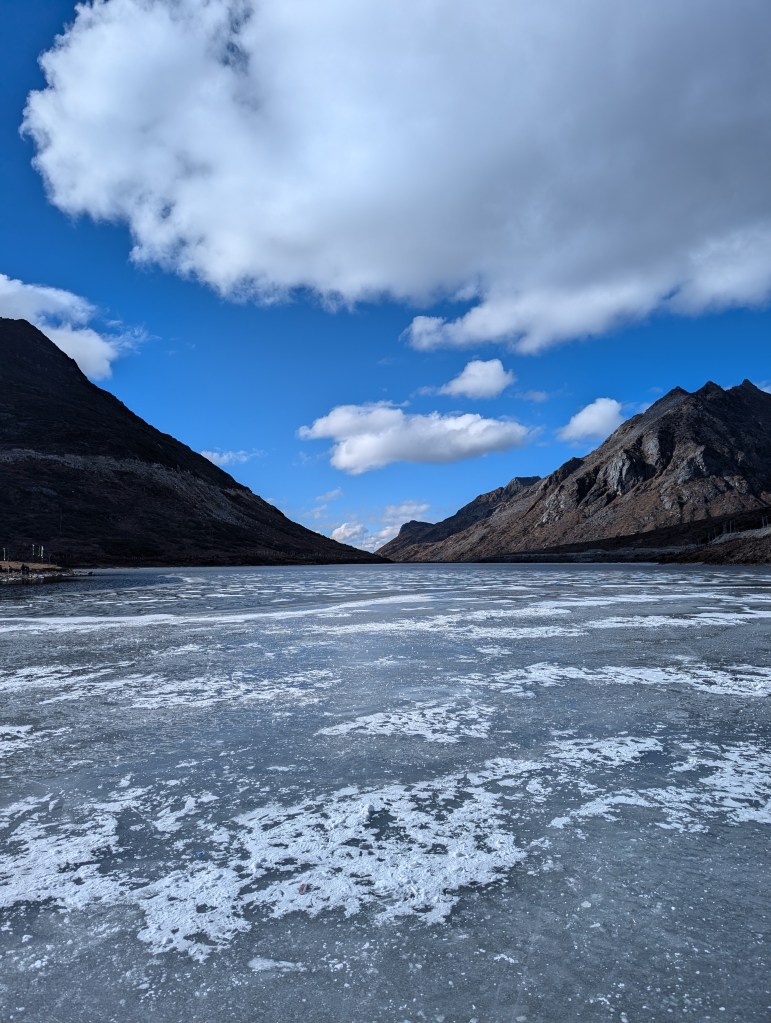
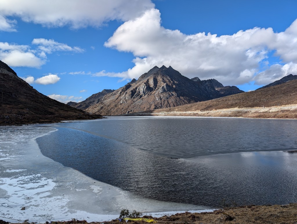
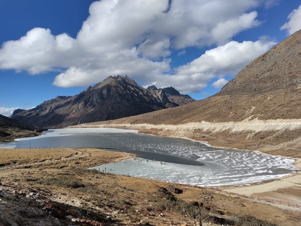
On another frozen lake, the ice was not so thick and cracked with my first step; this however was not as scary as my mother yelling at me from the back. The wry smile on my face was also wiped clean when a video of people falling into the Sela lake not 3 days later landed in my inbox. Another somber moment for me was finding the top of a packet of pan masala frozen into the water; I’ve unfortunately gotten used to seeing these scattered around our national monuments, but it was jarring to see it unmoving, trapped in a layer of ice (I’ll save you the heartbreaking picture).
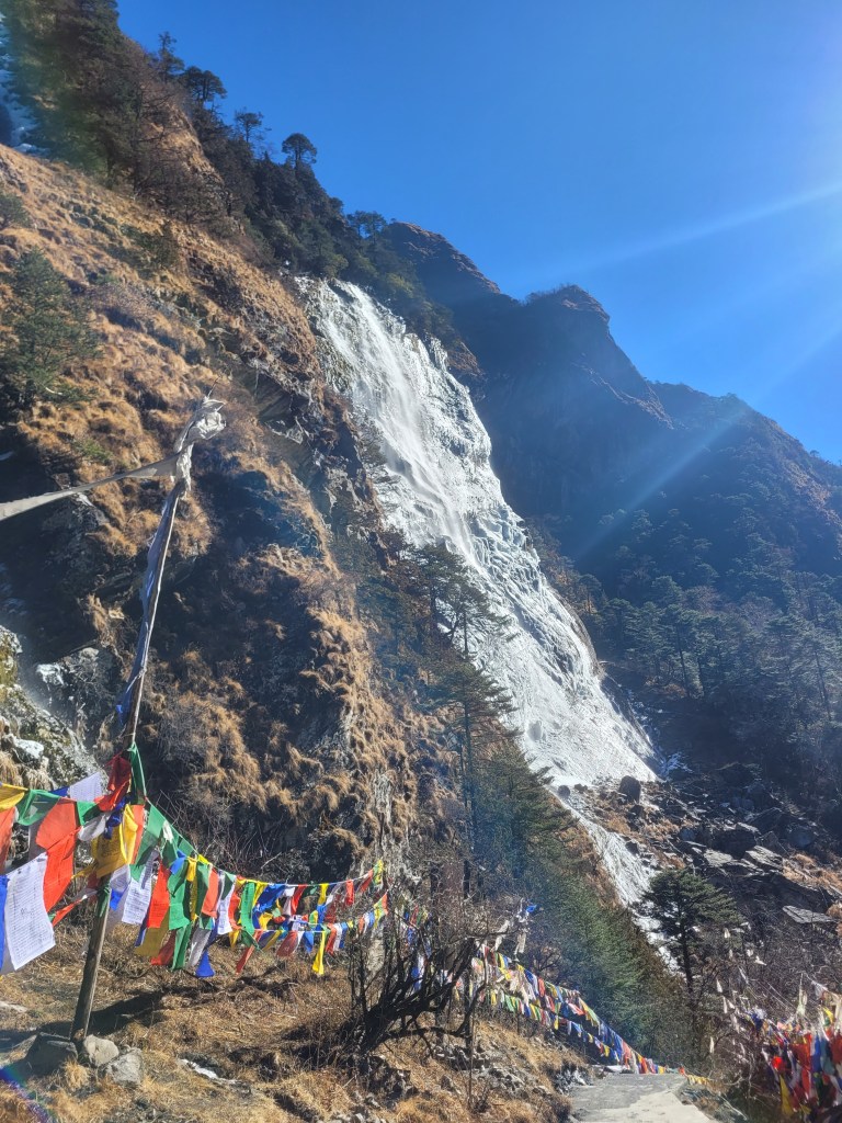
One of the prettiest drives was the 3.5hr trip from Tawang to Chumi Gyatse, the holy water falls, situated in the middle of an army outpost, right on the border with China (you could literally see Chinese roads, tourists, and a big portrait of Xi Jingping across a small river). These falls were said to have sprouted from 108 different holes in the side of a mountain as a direct result of a Buddhist priest scattering 108 religious beads praying for water in response to a deadly drought in the 8th century.
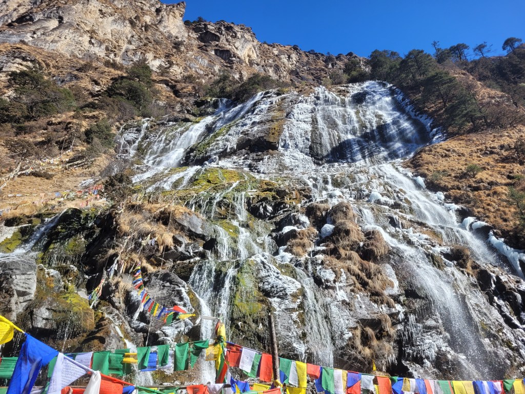
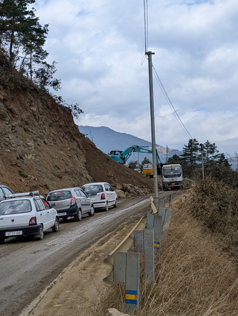
At the crack of dawn, we beat the arrival of the beaten-up Scorpio and its sleepy driver and began to climb. We soon entered heavy army territory, passing through multiple check posts but with a rather casual approach and virtually no checking of permits. The first half of the drive held similar scenery to what we’d been seeing – beautiful mountains, dry landscapes and frozen lakes! This beauty was only surpassed by even better roads – newly cemented in the last few months, there were only a few skull-rattling patches!
We had a surprise waiting for us as soon as we reached the peak of the first set of mountains! As we turned to descend into our destination valley, we were greeted by evergreens, snow-capped mountains in the distance, icy roads and fallen snow on its side! Closer to the actual outpost (as army movement thickened), we were stopped, identification checked, enquired about our lives, and, after passing their tests, rewarded with beautiful waterfalls and protein bars! As we walked through the falls and up-to the border, we had several candid conversations with our army guides who told us about their duties, schedules and lives – it was exceptionally rewarding!
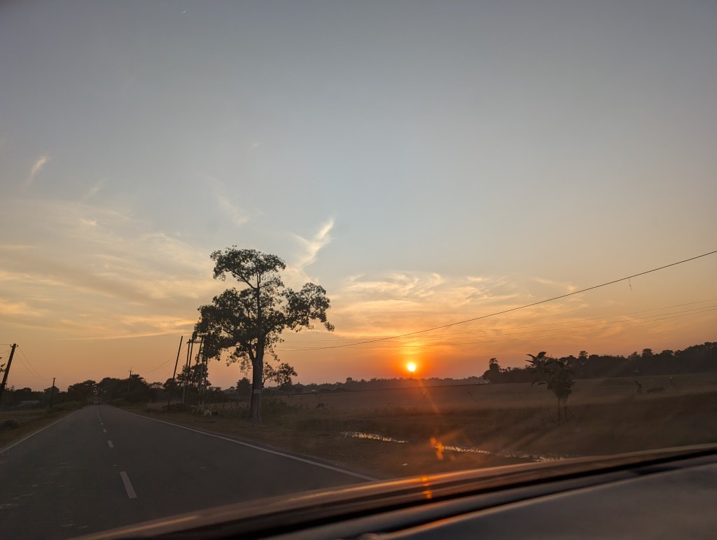
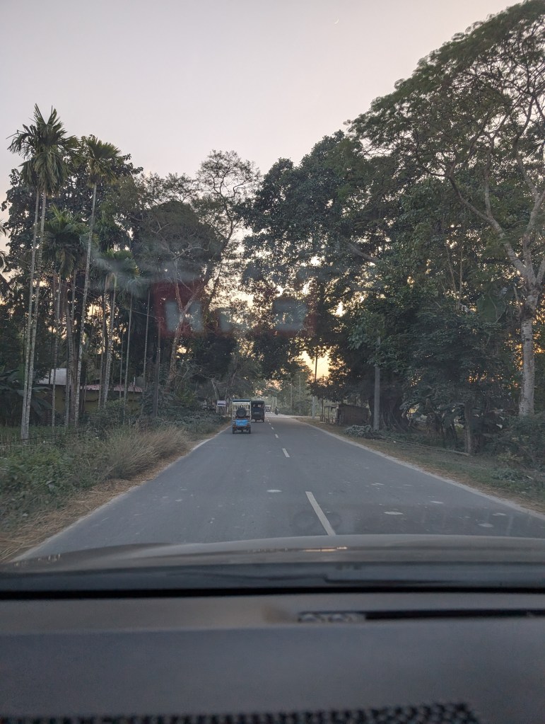
But the views didn’t stop when we sped downhill on day 8! The plains of Assam continued to deliver the most expansive horizons I’ve ever seen. Our single lane highway cut through farmland and densely packed trees on the edges of Assam’s abundant national forests. We’d sometimes be joined by picturesque single-track railway lines on our left as the greenery of pruned tea estates greeted us to our right. When the dark red sun set in the distance and dusk had its moment (albeit at 415pm), faint sunlight filtered through dusty horizons and covered my coveted mountains in a bit of a haze. Just serenity.
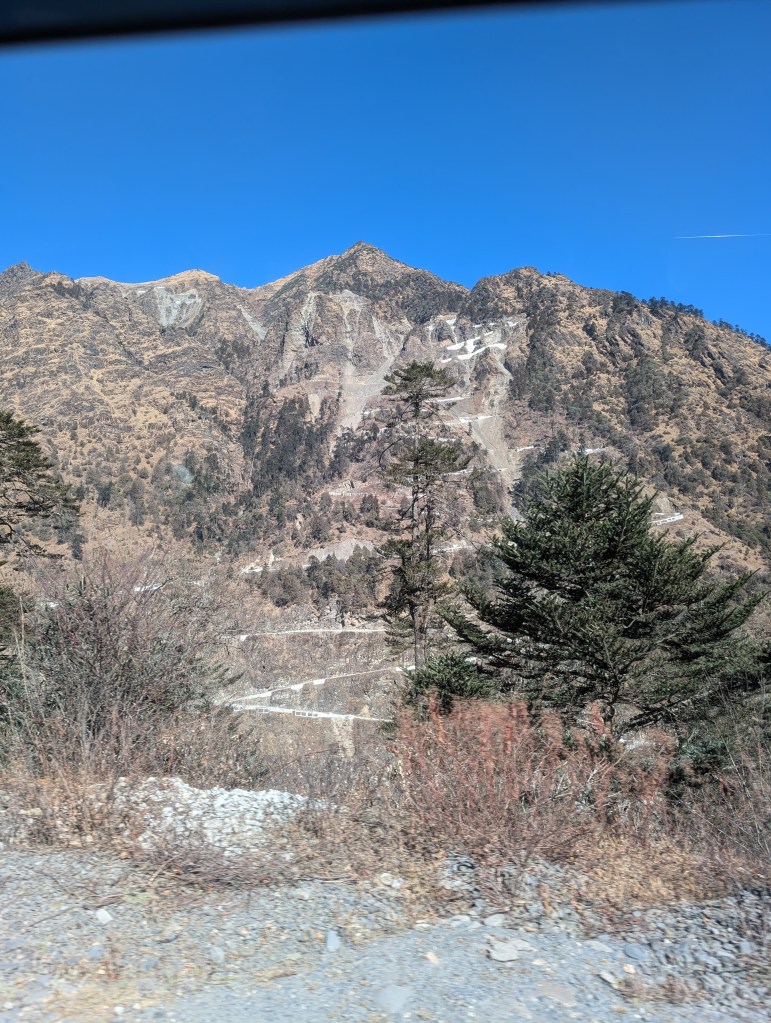
While learning about the prospect of a new airport being considered in Tawang or the fairly reasonable and regular helicopter service from Guwahati was gratifying when the long drives began to test us all, looking back I wouldn’t trade it for anything! The drives was the most significant part of this trip – truly a bit more special than actual destinations. There’s plenty of things to do on the way if you’re committed (here’s a few more wonderous valleys for you)!
[It’s also only fitting that I mention this here: Long-time readers of this blog will know why it’s important I highlight the fact that the old Santro Xing is the quintessential car of the region; not one street we rambled down did we not see my beloved car. One of our guides called her a ‘mini-Scorpio’, high praise for the mighty car!]
Borders
A blog about Arunachal Pradesh would be incomplete without addressing the heavy army presence in the area, and numerous border disputes with neighbouring China. Tawang, our main destination, hosted a huge army base; this was expected as the last major town before the border. However, not only was I surprised by the sheer size of their base, but even more by the amount of divisional bases that we saw along the way.
The army has been intertwined with this region since India’s independence. Here’s a brief history (I promise this won’t be super rambly!): In the early 1950s, Sardar VP, in his quest to have princely states join the Union, identified the need to integrate border regions of the North East Frontier Agency (present Arunachal). He dispatched different leaders to try to make connections with the local population – mostly those affiliated with monasteries or local tribes. The borders for Arunachal were drawn and decided upon by British India back in 1913 with the establishment of the McMahon line; this was always a thorn in neighboring China’s side. In 1962, China, displeased with the British division, attacked this region in hopes of gaining parts of Arunachal; Indian troops were outnumbered and caught by surprise, and despite a valiant defence, ultimately lost the Sino-Indian war in November of 1962. While no major territory was exchanged, it set Arunachal up as a key battlefront. Since then, both countries have been steadily increasing their troop presence in the area and have engaged in numerous small skirmishes.
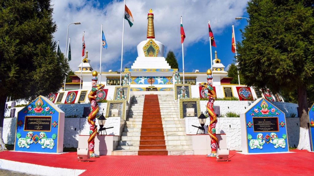
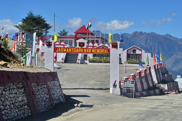
There has been significant investment in these army bases! The massive Tawang base does well in opening up its space to locals and tourists; it has spaces for cultural performances (featuring a local Yak dance!), a wonderful sound and light show featuring a film on the 1962 war, a heartwarming memorial for those who were martyred and numerous gardens and viewpoints. They also play host to the only recognizable museum in Tawang; while it is primarily dedicated to Major Bob Kathing, the army general who established independent India’s claim to Tawang, it holds interesting history of the region. Despite the hard-to-follow timelines, unpressed garments on display, and repetitive blurbs, it showcases a local Tawang hero; its well-built and holds so much potential!
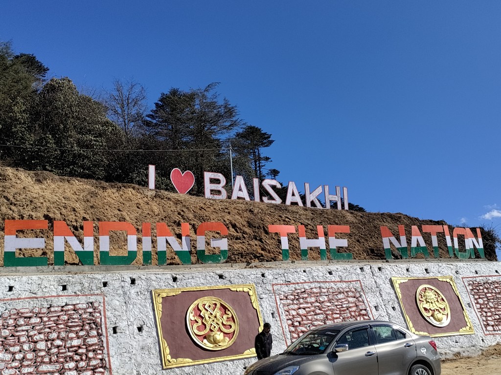
There are various army establishments one can stop at during long drives in the region. The most recognizable is a well-funded war memorial at Jaswantgarh, honoring heroes from a specific skirmish in the ’62 war, with a chance to see actual battlegrounds; the Baisakhi army canteen is the only place to get hot food close to the tenuous Sela Passs; and the ‘Ball of Fire’ infantry division in the Tenga Valley boasts their own museum (the most informative one in the region) and café.
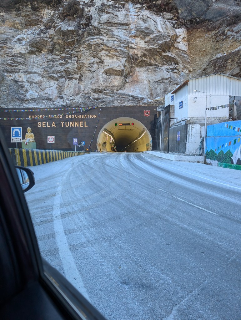
These long drives are made accessible by some major investment in the Border Roads Organization, a subsidiary of the Ministry of Defence and the driving force behind roads along India’s borders. They’ve been working in Arunachal since the 1960s under project ‘Vartak’, and have seen a 30% increase in their budget this year compared to last, with an overall 160% increase now since FY21-22, due to the perceived increasing threat from China. This makes sense – after speaking to candid army officials, much of India’s disadvantage on the border stems from the lack of suitable roads for army movement, whereas China’s quick deployment is a direct result of their connectivity. The scary clash in Yangtze in December 2022 (visible to us and a stone’s throw away from the holy waterfalls) saw India scramble to make it to the top of a plateau with no road. Now, tourists can see a long, picturesque winding road (only accessible to the army), built in response. What’s more, you can see the progress they are making in the region; the new Sela Tunnel, which reduces the drive to Tawang by an hour and can facilitate troop movement in the harsh winters is an engineering marvel! Still, my favorite piece of road is the one they were actively building in front of us!
The continued militarization and mobilization of armed forces in the region sparked an interesting debate in the car: did the army start as visitors in this region? Are they still visitors, or have they become the ‘locals?’ How much do locals, who often feel left out from the rest of mainland India, want to cooperate with fortification? Our local drivers, were hesitant to weigh in. While there is nothing but respect for those who’ve committed to serving their countries in the toughest of conditions and terrains, one wonders what an evolving symbiotic relationship will look like.
Religion and Culture
Western Arunachal Pradesh has a similar religious composition to its western neighbours, namely Bhutan and Nepal, with Buddhism seeing the most prominent following, highlighted by the several monasteries we visited (much to the detriment of half our squad).
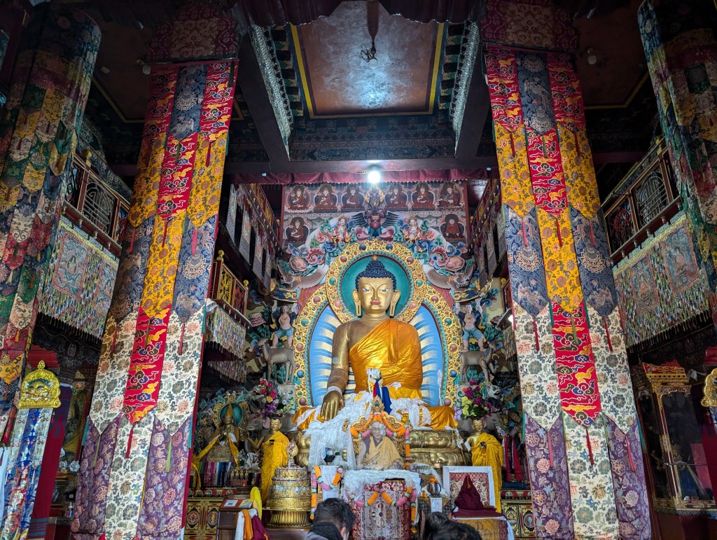
It was truly remarkable to see the different types and sizes of monasteries. Smaller towns (indeed, villages like Shergaon and Chug (Dirang)) that we visited had small but intricate monasteries; they also seemed to serve a town hall/community gathering purpose for these areas. Larger cities like Tawang had multiple elaborate monasteries with different purposes – some were nunneries, even some community parks. The Dirang monastery, perched atop a hill overlooking the river, was surprisingly expansive, and clearly the most expensive (though someone forgot to pay the contractor to make straight, consistent steps, ending up in a sloped fiasco that saw many twisted ankles). They all shared similar interiors – a picture of the Dalai Lama sat upon a pedestal in front of a golden incarnation of Buddha, colourful ceiling and hanging lanterns, red and yellow walls adorned with different visuals – some had portraits of all the Lamas, some pictures of the Four Sights, and some just had names of donors! The elaborate monasteries were perched on a hill and boasted a large Buddha statue on its roof, always facing east, and almost always overlooking the vast valley. The smaller, community monasteries were built wherever one found space, considering as many religious stipulations as possible.
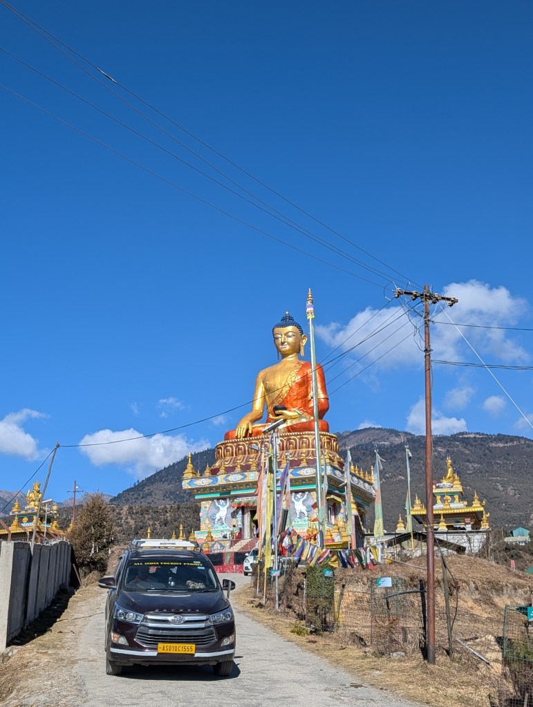
An interesting addition to the recently constructed ‘Buddha Park’ in Tawang that I feel compelled to share is the donor wall that serves as the foundation of the main monastery. Adorning the plaques were strong statements justifying donations as done with ‘the goal of achieving enlightenment’. While we can talk about the commercialization of religion for days, it was the first time I’d seen Buddhism sell ‘enlightenment’.
Switching gears a bit: There are a number of tribes indigenous to this area of which we were able to interact heavily with the Monpa community in the Chug Valley of Dirang. Through an elaborately planned walk through their village, we saw local holy sites (including a community monastery and the apparent resting place of a travelling saint); we dined with a surprisingly upscale, fancy 7-course meal in a tiny little house, meant to capture the essence of a local lunch and diet, which was primarily buckwheat and rice; saw a restored shack that served as a house for large Monpa families, and even observed the process of making hand-made paper! It was a great experience for us Mumbaikars who may not be rooted in a village anymore, despite desperately needing to return to a simpler life.
Future Tourism
Almost every holiday that we undertake is met uniformly by friends and family asking us why we can’t be normal. I find conventional holidays in the same-old places a bit unnecessary – why wouldn’t you want to go where most people don’t? Why not have an amazingly unique experience and build your holiday?
Arunachal is one of those less-trafficked spots of our country that is soon going to explode with tourists. They’ve been making steady investments in tourist infrastructure for the last few years, which has already seen increasing footfall. The locals have also identified this, and are trying to jump into the lucrative tourism game!
In the Chug valley, a single family (or rather, a 20-something year old woman herself) is basically running the tourist beat. She curates the local 7-course meal with produce from her grandparents farm, has restored her grandparent’s traditional Monpa cottage and runs a pretty thorough tour, and is employing and training her cousins to be guides!
There are self-starters in the accommodation game as well! The most common types of lodging in off-beat villages and small towns are ‘homestays’. While conventionally this meant living in a host’s house with a few number of rooms, the locals have identified the pull of such living and started building cottages in modest properties on generational land; more profitable than farming, but still seasonally driven!
It would also be remiss of me to not mention the work of ChaloHoppo, a tour operator working solely in the Northeast; they created our expansive itinerary, took care of identifying and booking accommodation, permits and local guides, and even arranged for transportation. They also operate group tours for solo travellers, and are pretty impressive with their logistics and communication! Their work is greatly contributing to making the Northeast a more accessible tourist destination!
Fin.
I hope the reading adventure you chose inspires you to choose your own travel adventure and embrace the unconventional! India has so much to offer, and it’s only getting better. Let me know where you’re hoping to go in the comments!
As a show of gratitude for sticking with me to the end of this blog, here’s my promised surprise (with a bit of a preamble, because, well, have you met me?)
The Border Roads Organization (BRO) puts up humorous safety signs along all its roads, to hopefully reinforce safe driving. While the puns are always intentional, they seem to slip in inspirational quotes. I’ve taken the liberty of putting together a list of all the quotes we saw along our travels (over 100 of them!) in this document.
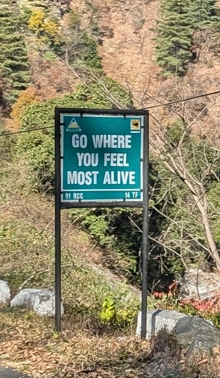
In case you’re wondering what the small acronyms are: 14 TF is BRO’s 14th Task Force, and boasts the clever tagline “Fikar not fourteen”; RCC are Road Construction Companies. Further down in the valley, 97 RCC proudly declares that “Ninety seven only heaven”.
Some of my favourite safety themed quotes include “Safety on road is Safe Tea at home” and “Make this bend your friend”! For ones that cause introspection, I liked “One positive thought is enough to spark a successful journey” and “It’s not the mountain we conquer but ourselves”. But my overall favorite has to be “Traveling leaves you speechless then turns you into a storyteller”!

One reply on “The Land of Dawn-lit Mountains”
Thank you for having us be part of your journey, Raghav. I got an opportunity to experience the East in probably the best way possible, second only to being there myself.
Keep writing (and travelling)!
Thanks, Gaurav Khemka
LikeLike